HSL
水路測量ランチ

アイコン 意味
戦闘や事故で失った場合(沈没、墜落)や損傷した場合、艦船などの内部で事故や事件がおこった場合の意味です。自軍や同盟軍、所属機関、所有会社が行った沈没処分や破壊処分、漁礁としてまたは演習で使用して沈めた場合にはこのアイコンは付けません
戦果や功績、各機関に寄贈された場合の意味です。戦争などで沈没し、何十年後に発見された場合もこのアイコンです
映画やTVドラマ、ドキュメンタリーに使用された場合の意味です
参考文献、小説や書籍に登場する事柄です
インターネットやTVゲームに登場する事柄です
UFOなど超常現象に遭遇した事柄です
※HSLはHydrographic Survey Launch vesselの略で、艦種記号ではない
全長:10.36m
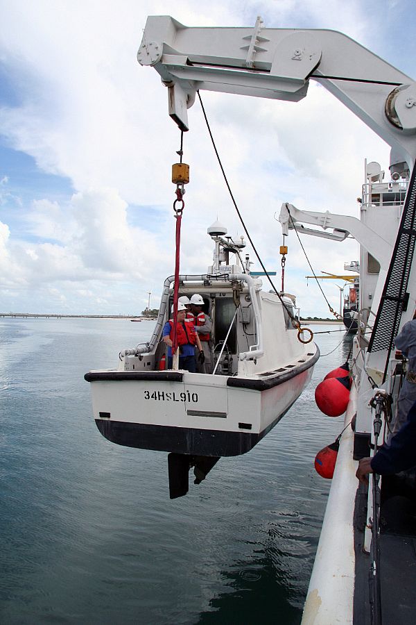
↑FORTALEZA, Brazil (March 27, 2010) Surveyors from the Naval Oceanographic Office and Brazilian hydrographic officers are lowered in a hydrographic survey launch vessel from the Military Sealift Command oceanographic survey ship USNS Henson (T-AGS-63) in the Port of Fortaleza. The boat is 34HSL910. The surveyors conducted a shallow water survey demonstration for the Brazilian officers. Henson is participating in Oceanographic-Southern Partnership Station (O-SPS), an exercise focused on oceanographic surveying and the exchange of information between subject matter experts with partner nations in the U.S. Southern Command area of responsibility. U.S. Navy photo by Mass Communication Specialist 2nd Class Lily Daniels. (Released)
艦名 NAME 艦種記号 建造所 就役日 退役日 除籍日 備考
34HSLシリーズ


Update 23/05/09